The Technology
The stmap Lifecycle
From raw orthophotos to georeferenced stone-by-stone analysis. Our pipeline combines state-of-the-art computer vision with specialized domain knowledge in masonry.
Input: High-Resolution Imaging
We process ultra-high-resolution orthophotos (RGB, Ambient Occlusion, and Normal maps). These provide the raw geometric and visual information needed for accurate stone detection.
- Support for Multi-GB GeoTIFFs
- Sub-millimeter Ground Sampling Distance (GSD)

Training: Domain Adaptation
Our models are trained on a diverse dataset of over 24 masonry sources, including sandstone, brick, and natural stone. We use advanced augmentation and active learning loops to ensure robustness.
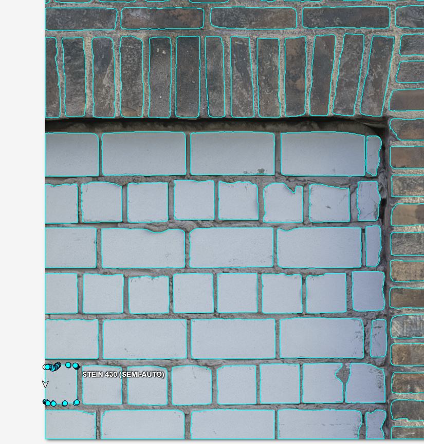
Output: Precise Vectorization
The final output is not just a mask, but individual georeferenced polygons. Each stone is identified as a unique instance, ready for damage assessment and monitoring.

Ready to map your masonry?
Join our pilot program and get automated stone analysis for your restoration projects.
Get Started